Kukule Ganga Power Station

The Kukule Ganga is one of the main tributaries of the Kalu river which records the highest annual water yield out of all rivers in the country. Even though the Kukule basin accounts for only one nineth of the total basin area of the Kalu river, it contributes to a quarter of the total water yield of the Kalu river making it a potential source of hydro power and irrigation. In addition to that, its massive water flow, especially during monsoons, inundates floodplain of the river every year inconveniencing the public and destroying swaths of paddy lands. Further, the high-water yield in the Kukule Ganga had been considered for irrigating the dry zone of southern part of Sri Lanka too. Considering those potential and requirements, several studies had been conducted to investigate the viability of constructing multipurpose reservoirs on the Kukule Ganga since 1968. However, those proposals were not implemented due to their less economic viability and adverse social and environmental impacts.
After a long delay, the Kukule Ganga Hydro Power Plant was proposed to be constructed as a run-of-the-river type (ROR) power plant following a feasibility study conducted by JVK (Joint Venture Kukule) in 1992. As per this study, both intake and outfall were planned to be constructed on the Kukule Ganga itself with the weir at Paragala to hold a limited volume of water. Because of the ROR status of the proposal, environmental and social concerns of the project were found to be negligible compared to previous studies which involved bigger reservoirs. The project was started in 1999 with the financial assistance from Japan Bank for International Cooperation (JBIC) and the power plant was commissioned on September 19, 2003.
The Kukule Ganga Power Plant, which is underground and unmanned, is the first-ever run-of-the-river type (ROR) power plant in the country that consists of two generators of 35MW driven by Francis type turbines. The turbines of the power plant are fed by the water diverted from the Kukule headpond through a 5.79km long headrace tunnel and the water discharged from the turbines is carried through a 1.6km long tailrace tunnel and falls into the same river 8km downstream to the intake. The Kukule headpond is a single purpose very small reservoir created by the diversion weir to regulate river flow for the purpose of daily peak generation of electricity. The headpond stretches over 16km along the river which forms a gorge to hold some water. The full supply level (FSL) and minimum operating level (MOL) of the pond is 206masl and 204masl respectively with gross storage below FSL, 3.46 MCM. However, the active storage is limited to 1.79MCM as turbines are allowed to operate only within the band of 206-204 masl.
The expected average annual energy from the power plant is 317 million units with plant factor above 50%. During the 20-year period ending in 2023, the power plant has recorded generations more than the above target fifteen times out of 20 years with 401 million units being the record highest in 2021. Due to extended wet weather prevailing in the upper reaches of the river, the plant is responsible for higher energy production despite storage constraints owing to its ROR status.
The plant, being ROR type, generates less energy during the dry spell from January to April as inflows drop drastically during this period. In contrast, during monsoons inflows are frequently recorded well above 100 cubic meters per second making excess water to be discharged through four radial gates. The rainfall and inflow are so high during the monsoons that water spills as many as sixty to seventy days a year. Because of this, low lying areas downstream in Bulathsinhala Division flood several times a year wasting 15% of the potential energy.
There is a misconception among the public that flooding has become more intense and frequent after the Kukule Ganga project was implemented. But there is no truth in it as the water flow remains the same in case of high flow situations in the river. (When the inflow is high, part of the water flows through turbines while the balance is discharged through spillway gates equaling the inflow and outflow).
- Installed capacity 2 x 35 MW
- Expected annual average energy 317 MWh
- Commissioned in 2003
- Main contractors
- Civil – K.K.H (Kajimaa-Kumagai-Hazama Join venyure),JVK Civil work supervision group,Sknska International Civil Engineering
- Electromechanical – Noell Stahl-& maschinenbau GmbH,Mitsui & Co. Ltd.,Consortium VATECH HYDRO
- Hydro mechanical – Mitsui & Co. Ltd.
- Transmission Lines – ENERGIE Of Germany ,Lanka Transformers Ltd.
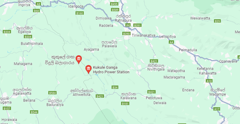
- Located 86 km south-east of colombo
- Reservoir
- Catchment area : 312 km^2
- Usable water volume : 1.67 MCM
- Full spill level : 206 masl
- Minimum operating level : 204 masl
- Headrace Tunnel
- Mostly unlined tunnel with paved invert
- 5.6m diameter
- 5799 m length
- Tailrace
- Length -1600 m
- Type – A mostly unlined tunnel with paved invert Size – Hosreshoe 6.4 m in unlined portions
5.6 m Diameter in concrete lined portions
-
Tunnel slope 0.58 % (riverse slope)
-
Invert elevation before outfall 13.52 masl
- Generator (TOSHIBA)
- Number of Units – 2
- Rated speed 500 rpm
- Type vertical shaft, 3-phase synchronous generator
- Rated voltage 13.8 kV (+/-) 7.5 %
- Rated output power 42 MVA
- output power 46.2 MVA
- Power factor 8.5
- Frequency 50 Hz
- Exciter-rated voltage 94.8 V
- 12 pole-rated current 1550 A
- Turbine (TOSHIBA)
- Vertical Francis
- Number of Units – 2
- Maximum Output power – 40 MW
- Speed – 500 rpm
- Rated discharge : 24 m^3 / s at 37.5 MW of 1 Unit
- Maximum gross head 186.4 m
- Max. net head – 176.1 m (2 units at full load)
- Min. net head – 174.1m